
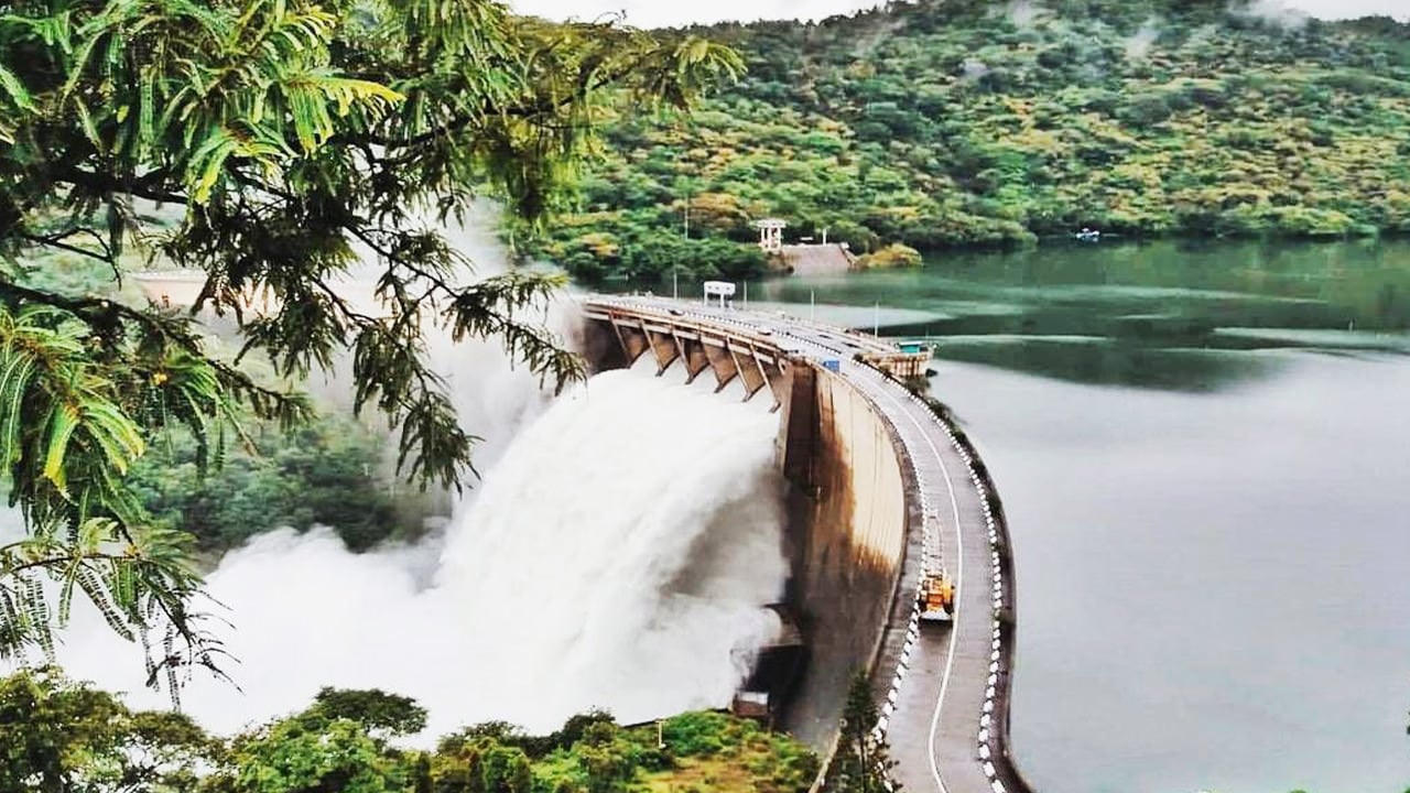
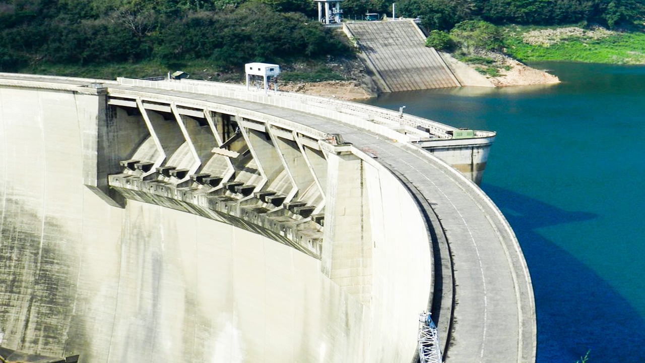
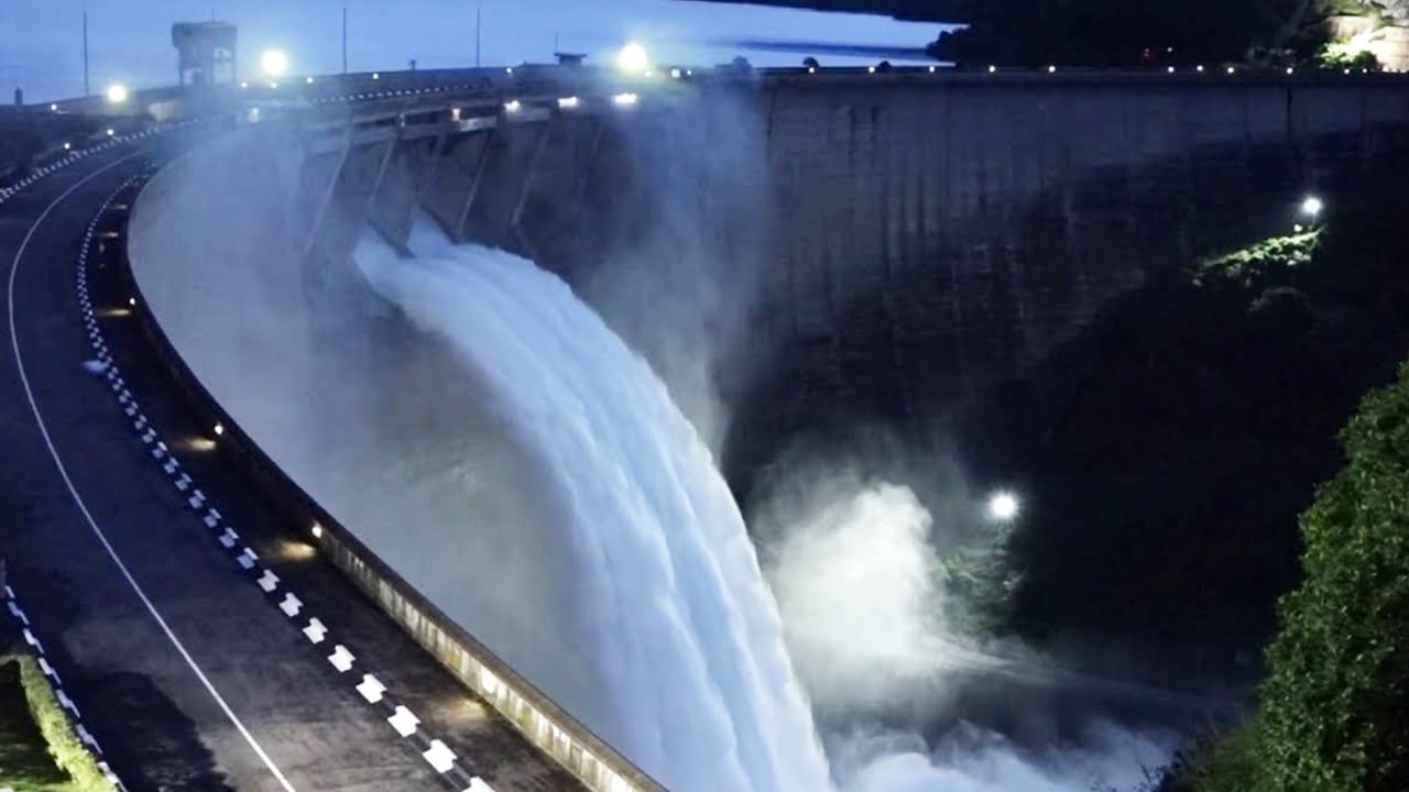
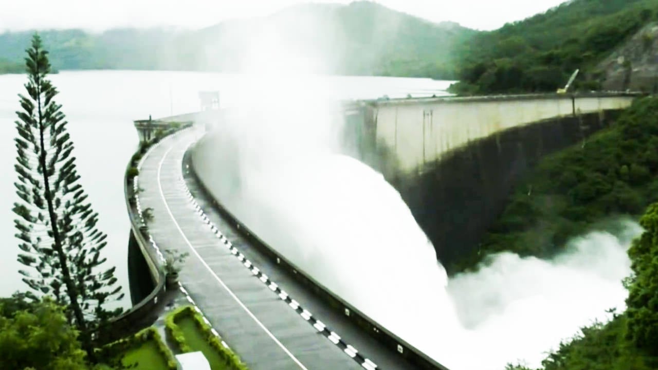
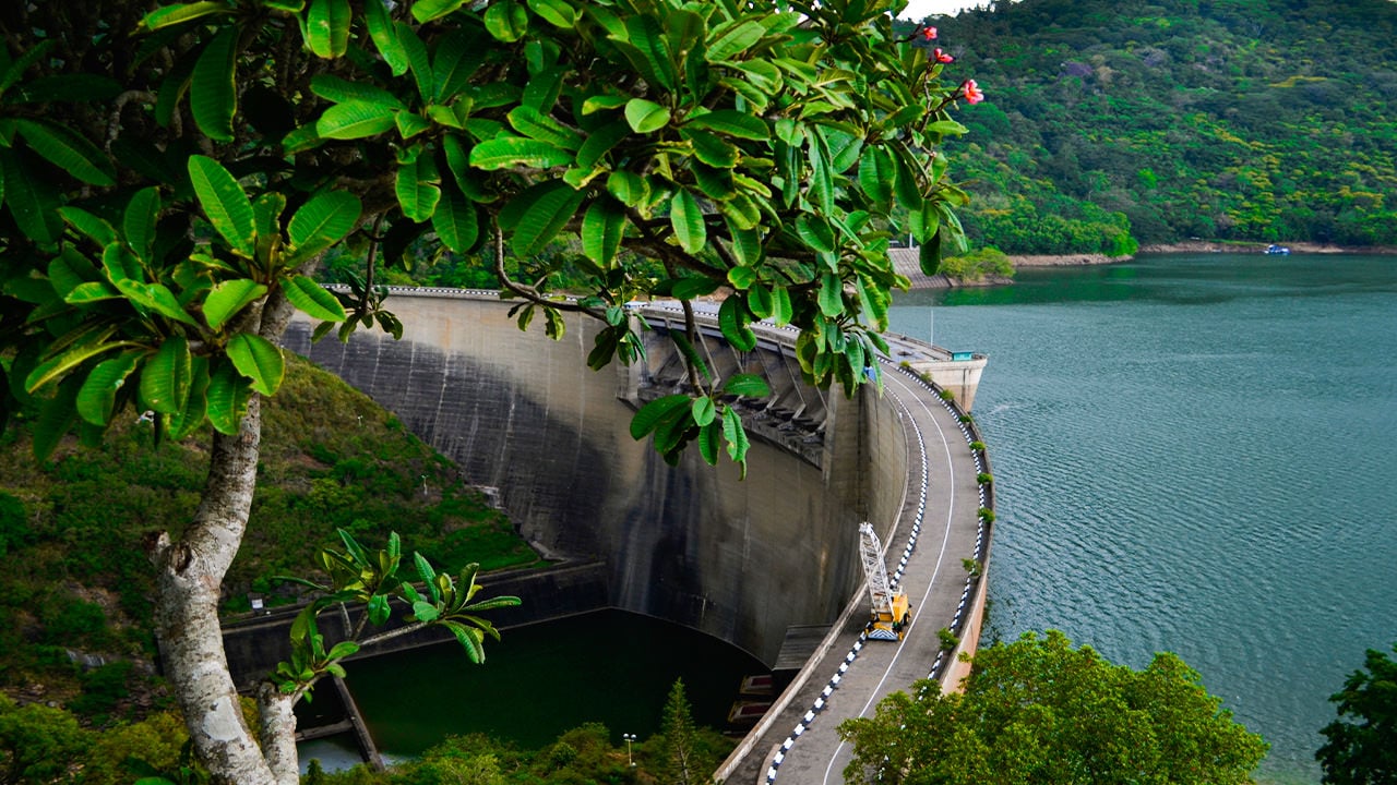
Set among mist-covered ridges and tea-clad hillsides roughly 32 km east of Kandy, Victoria Dam is Sri Lanka's tallest dam and one of the most significant infrastructure achievements in the country's modern history. Built as part of the Mahaweli Development Project — the largest river-diversion scheme ever undertaken in Sri Lanka — the dam harnesses the power of the Mahaweli River to generate electricity for much of the island. For visitors, it combines genuine engineering spectacle with a scenic drive through the central highlands.
What is the history behind Victoria Dam?
Construction began in 1978 at a deep gorge just above the Victoria Falls rapids, at a point approximately 300 metres downstream from where the Hulu Ganga joins the Mahaweli River. Funding, design, and technical expertise were provided by the United Kingdom, and the project carries several notable royal associations: Queen Elizabeth II visited the construction site on 24 October 1981, and the dam was formally opened in 1985 by Margaret Thatcher, then Prime Minister of the United Kingdom.
The dam is classified as a double-curvature arch dam — a design that transfers water pressure laterally into the canyon walls rather than relying solely on the dam's mass. Its innovative self-regulating spillway gates, which require power only to close (not to open), earned an award for Innovative Design in Civil Engineering from the Institution of Civil Engineers.
What are the key engineering facts about Victoria Dam?
| Feature | Measurement |
|---|---|
| Dam height | 122 m |
| Dam length (crest) | 520 m |
| Crest width | 6 m |
| Base width | 25 m |
| Number of spillways | 8 (each 12.5 m wide × 6.5 m high) |
| Maximum discharge capacity | 8,200 m³/s |
| Penstock tunnel length | 5,646 m |
| Installed generating capacity | 3 × 70 MW turbines (210 MW total) |
| Annual energy generation | up to 780 GWh |
Water travels from the reservoir through a 5,646-metre tunnel to a powerhouse below, where three 70 MW turbines operating at a net head of 190 metres generate electricity fed into the national grid. Two low-level sluices at the dam's base allow engineers to purge accumulated silt — a common maintenance challenge for large reservoirs in tropical environments.
What is the Victoria Reservoir like?
The reservoir created by the dam covers a surface area of approximately 22.7 km² with a gross storage capacity of around 722 million cubic metres. Its shoreline weaves between forested headlands, and the water takes on deep jade tones during the wet months. Birdlife along the margins is varied, and the surrounding landscape — part highland forest, part Ceylon tea country — makes the drive to the dam as rewarding as the destination itself.
Beneath the reservoir lies the old town of Teldeniya, inundated when the reservoir was first filled. During exceptionally dry years, water levels drop far enough to expose the skeletal outlines of submerged structures, drawing curious visitors who come to glimpse the ghost town rising briefly from the water.
What else can I explore near Victoria Dam?
The dam sits close to a cluster of natural and cultural landmarks that reward a longer half-day or full-day excursion from Kandy. Travelling east along the same A26 Mahiyangana Road takes you deeper into the Knuckles range foothills, with opportunities for short forest walks and river bathing. Those with more time can continue to Randenigala Dam, another Mahaweli scheme structure further upstream, which offers similarly dramatic views and far fewer visitors than its more famous neighbour.
The historic city of Kandy — Sri Lanka's cultural capital and home to the Esala Perahera Festival — is the logical base for a visit. A Kandy city tour pairs naturally with an afternoon drive to the dam, covering the distance comfortably within a single day.
How do I get to Victoria Dam from Kandy?
The dam is accessible only from its north-east side via the Kandy–Mahiyangana Road (A26). From Kandy, drive approximately 32 km through Kundasale and Rajawella. At Moragahamula Junction, turn onto the road signposted for the Victoria Dam Observation Point and continue a further 8 km to reach the viewing area. The total journey typically takes around one hour depending on traffic through the Kandy outskirts.
- The Observation Centre at the dam provides unobstructed views across the spillways and the reservoir beyond.
- There is no public bus service directly to the observation point; a private vehicle or tuk-tuk is the practical option.
- The road is paved throughout but narrow in sections — allow extra time if driving a larger vehicle.
When is the best time to visit Victoria Dam?
The dam can be visited year-round, but the experience varies significantly by season. The inter-monsoon months of February to April and August to September tend to offer the clearest skies and the most reliable road conditions. During the south-west monsoon (May to July), the central highlands receive heavy rainfall; the reservoir fills rapidly during this period, which can make the spillways more dramatic to observe, though low cloud sometimes obscures the surrounding hills.
Visitors hoping to see the submerged Teldeniya township should aim for the driest part of the year — typically February to March — when reservoir levels are at their lowest and the outlines of old structures are most visible.
Is there an entry fee for Victoria Dam?
There is currently no general admission charge to visit the Victoria Dam Observation Centre, though this is subject to change. Visitors should carry identification, as the dam is a functioning power-generation facility and access may be restricted by the Ceylon Electricity Board at any time. It is advisable to check locally or with your driver before making the trip a centrepiece of your itinerary.
Nearby places
9 places within about 25 km, nearest first.
- Gerandi Ella Fallsunder 1 km
- Walapane Coffee4 km
- Ambakumbura6 km
- Victoria Golf Resort6 km
- Ura Kanda7 km
- Digana7 km
- Ulapane8 km
- MOOLOYA8 km
- Daha Ata Wanguwa (18 Bends Road)8 km