The Pekoe Trail is Sri Lanka's first long-distance walking trail, threading more than 300 kilometres through the central highlands on foot. Conceived by adventurer Miguel Cunat and developed with support from the EU and USAID, it is divided into 22 stages that range from gentle half-day walks to demanding full-day treks — meaning you can cherry-pick a few stages or commit to the entire route over several weeks.
What is the Pekoe Trail?
Named after the grade of rolled Ceylon Tea leaf, the trail knits together landscapes that most visitors to Sri Lanka never see: colonial-era tea estates, cloud-forest ridgelines, paddy terraces, waterfalls tucked behind jungle walls, and small communities whose rhythms have barely changed in a century. The route passes through hill towns, remote villages, wildlife sanctuaries, forest reserves, viewpoints, and places of deep cultural and religious significance.
Each of the 22 stages has been waymarked and documented so that independent walkers can navigate with confidence. Guided options are also available for those who prefer a local expert on hand to interpret the landscape, introduce villagers, and handle logistics.
Which route does the Pekoe Trail follow?
The trail begins in Kandy — the cultural heart of the highlands — and winds south and east through the tea country before descending toward Ella. Along the way it crosses several of Sri Lanka's most recognisable hill districts: Matale, Nuwara Eliya, Badulla, and Uva. Key waypoints include the Horton Plains National Park escarpment, the Uva basin, and numerous small estate bungalows and forest lodges.
- Total distance: over 300 km across 22 stages
- Start point: Kandy
- End point: Badulla region (varying by itinerary)
- Stage length: typically 10–20 km per day
- Terrain: paved estate roads, jungle paths, grassy ridges, and rocky ascents
How difficult is the Pekoe Trail?
Difficulty varies considerably between stages. Several stages follow estate roads at relatively modest gradients and suit walkers with moderate fitness. Others cross steep jungle terrain with significant elevation gain and are better suited to experienced hikers. The trail's official stage notes describe each section's distance, elevation change, and estimated walking time, so it is possible to plan a trip matched to your ability.
Altitude is a factor across much of the route, with many stages sitting above 1,500 m. Temperatures are mild to cool — rarely exceeding 25 °C and sometimes dropping sharply in the evenings — so layering is essential even in the dry season.
When is the best time to walk the Pekoe Trail?
The central highlands experience two distinct monsoon patterns. The southwest monsoon brings heavy rain to the Kandy and Nuwara Eliya sides roughly between May and August, while the northeast monsoon affects the Uva and Badulla sides from October to January. This means no single window is universally dry across all 22 stages.
In practice, most walkers prefer the periods from January to April and August to October, when at least the majority of the route tends to be drier. A light rain jacket and waterproof pack cover are advisable year-round. Misty mornings are common and often spectacular, particularly on ridges above the Sinharaja watershed.
What will you see and experience along the way?
The Pekoe Trail is as much a cultural journey as a physical one. Walkers pass through small market towns where spice traders, tea vendors, and dairy farmers share the street. Visits to working tea factories reveal the full process from plucked leaf to finished cup — a complementary backdrop to what you read about Ceylon green tea and its relatives.
- Guided tours of active tea estates and factory floors
- Hidden waterfalls and natural swimming holes reached by short detours
- Forest reserves harbouring endemic birds, leopards, and sambar deer
- Buddhist temples, Hindu kovils, and colonial-era churches in the same village
- Homestay and guesthouse accommodation run by local families
- Village kitchens where you can watch — and taste — hill-country cooking
The Bluefield Tea Gardens near Nuwara Eliya is one of several estates accessible from the trail where visitors can walk the plucking fields and learn how altitude and rainfall shape flavour.
How do I plan accommodation along the Pekoe Trail?
Accommodation ranges from simple homestays in estate worker communities to boutique bungalows converted from colonial planters' residences. Some stage end-points have only one or two guesthouses, so advance booking is strongly recommended during peak months. Lakpura can arrange a pre-planned accommodation sequence for any number of stages, including transfers for luggage if you prefer to walk with a daypack only.
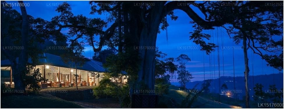
For a particularly characterful base in Nuwara Eliya, The Grand Hotel sits in a restored 19th-century building that captures the colonial atmosphere of the tea highlands. Further along the route, small lodges near Ella offer views across the Uva valley.
How do I get to and from the Pekoe Trail?
Kandy is around 115 km from Colombo and is well served by train and road. The scenic railway from Colombo Fort to Kandy takes roughly three hours and is a pleasant way to begin the journey. For those completing only selected stages, Lakpura can arrange a private driver to drop you at the start of any stage and collect you at the end — useful when stages begin or end in villages with no public transport.
The Kandy city tour makes a natural introduction before you set off on foot: the city's temples, markets, and lake establish the cultural context you will carry with you along the entire trail.
What is the ethos behind the Pekoe Trail?
The trail was designed explicitly around sustainable travel. Revenue from guided stages and accommodation stays flows directly into local communities rather than large resort groups. Waymarking was done with low environmental impact and with the cooperation of estate management and village leaders. The project reflects a growing ambition for Sri Lanka to offer world-class long-distance walking — comparable to trails in Nepal, Portugal, and Bhutan — while keeping tourism income close to the landscapes that generate it.
Walkers are encouraged to carry reusable water bottles (highland water sources are generally clean and can be treated), to use local guides wherever possible, and to observe the dress codes appropriate to temple and mosque communities on the route.
Can I walk the Pekoe Trail independently?
Yes. Stage maps and waymarks are publicly available, and many experienced hikers complete sections independently. That said, a local guide adds significant value: they know which paths flood in wet weather, which shortcuts the maps don't show, and which family along the route serves the best rice and curry. Lakpura can match you with a certified guide for individual stages or for the full route.
The full trail, stage by stage
22 waymarked stages covering 316 km on foot, from Hantana to Pedro Estate.
- Walking route
- Stage start
- 1Hantana – Galaha13.4 km
- 2Galaha – Loolkandura14.8 km
- 3Loolkandura – Tawalantenne18.0 km
- 4Tawalanthenne – Pundaloya15.5 km
- 5Pundaloya – Watagoda14.3 km
- 6Wattagoda – Kotagala15.3 km
- 7Kotagala – Norwood17.1 km
- 8Norwood – Bogawantalawa15.6 km
- 9Bogawantalawa – Dayagama16.8 km
- 10Dayagama – Horton Plains15.5 km
- 11Horton Plains – Udaweriya13.3 km
- 12Udaweriya – Haputale17.1 km
- 13Haputale – St. Catherine13.6 km
- 14St. Catherine (Lipton Seat) – Makulella9.4 km
- 15Makulela – Ella9.5 km
- 16Ella – Demodera9.4 km
- 17Demodera – Hali-Ela13.9 km
- 18Hali-Ela – Ettampitiya13.8 km
- 19Ettampitiya – Lunuwatte19.2 km
- 20Lunuwatte – Uda Pussellawa12.5 km
- 21Uda Pussellawa – Kandapola16.9 km
- 22Kandapola – Pedro Estate11.0 km
Distances are measured from the mapped route. A few short sections are not yet surveyed and show as gaps in the line — the trail itself is continuous and waymarked on the ground.
Route geometry © OpenStreetMap contributors, available under the Open Database Licence.