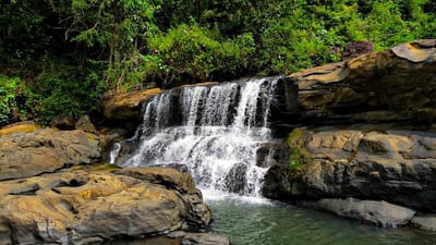
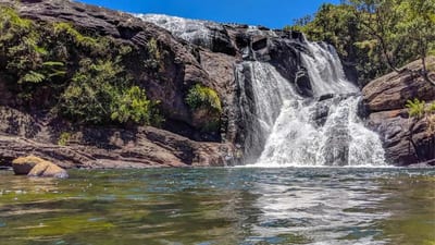
Bambarakanda Ella drops 263 metres (863 feet) through pine-clad slopes in the Kalupahana area of Badulla District, making it the tallest waterfall in Sri Lanka and one of the highest horsetail falls in Asia. Ranked around 299th among the world's tallest waterfalls, it originates from Kuda Oya, a tributary of the Walawe River, and its white ribbon of water is visible from the A4 highway just 5 kilometres before Kalupahana junction. The combination of accessible location, a genuine hiking trail, and a natural bathing pool at the base makes Bambarakanda one of the most rewarding day trips from the hill-country town of Ella.
What makes Bambarakanda Ella a horsetail waterfall?
A horsetail waterfall is defined by the water maintaining near-continuous contact with the rock face as it descends — unlike a free-falling plunge waterfall. At Bambarakanda, the water slides along an almost vertical granite escarpment, fanning slightly as it gains speed, which produces the characteristic white veil shape most visitors photograph. The cliff face itself is formed by an ancient geological fault line running through the Central Highlands, and the surrounding pine plantation was established in the mid-20th century to stabilise the steep slopes.
When is the best time to visit Bambarakanda Ella?
The falls are at their most impressive between March and May, when the inter-monsoonal rains push a strong, full flow of water over the crest. This is the optimal window for photography: the cascade is wide, the surrounding vegetation is lush, and the mountain mist is manageable.
- March – May: Peak flow, ideal for both viewing and hiking.
- June – September: Drier season; the falls thin considerably but the trail is drier underfoot and leech activity is lower.
- October – February: Heavy monsoon rains, particularly November to January, can make the approach road slippery and the base of the falls inaccessible or unsafe. Trail conditions deteriorate significantly.
If your priority is hiking to the crest rather than maximum water volume, the April-to-September window offers the best trail conditions overall.
What is there to do at Bambarakanda Ella?
Most visitors spend two to four hours at the site, splitting time between the base and — for those who are fit — the crest trail.
- Swimming and bathing: A natural rock pool complex forms at the base of the falls. The water is cold and fast-moving after rain, so check conditions on arrival.
- Picnicking: The grassy clearings around the pool are a popular spot for packed lunches. A few informal food stalls typically operate near the roadside trailhead.
- Photography: The late-morning light (roughly 9–11 a.m.) illuminates the full height of the falls from the viewpoint opposite the base pool.
- Hiking to the crest: A marked 1.6 km trail climbs to the top of the falls, described in detail below.
How do I hike to the top of Bambarakanda Falls?
The trail to the crest is rated easy to moderate and is manageable for reasonably fit walkers. No permit is required. The trailhead — locally known as Bambarakanda Rest — sits at roughly 1,110 m elevation on the main road, and the trail ends at the crest at approximately 1,228 m, giving an effective elevation gain of around 200 m despite the path dipping before it climbs.
| Trail detail | Information |
|---|---|
| Total length | 1.6 km (one way) |
| Elevation gain | ~200 m (net) |
| Trailhead elevation | ~1,110 m |
| Crest elevation | ~1,228 m |
| Approximate time | 1.5 hours one way |
| Difficulty | Easy to moderate |
| Best hiking season | April – September |
| Permit required | No |
Section 1 (0–900 m): From the trailhead, turn right off the main road onto a footpath leading toward the base of the falls. After roughly 150 m, take a second right to join a path coming from the roadside. Cross a small bridge, then climb gently through a section of pine plantation. At the 50 m mark inside the pines, bear right to reach the base of the falls and the pool.
Section 2 (900 m–1,300 m): The trail intensifies here with a series of hairpin switchbacks through dense pine forest. This section demands steady footing. Near the top of the wooded stretch, a natural viewpoint opens toward Horton Plains and the valley roads below.
Section 3 (1,300 m–1,600 m): Turn right onto a trail that re-enters the treeline with a steep final climb to the crest. At the top, a miniature waterfall feeds a large natural pool — the source of the main drop. Views across the eastern plains on a clear day extend for many kilometres.
What should I bring and wear for the hike?
Preparation is straightforward but worth taking seriously, particularly in wetter months when the trail becomes slippery.
- Footwear: Sturdy hiking boots or trail shoes with grip. Sandals and flip-flops are not suitable.
- Water: Carry at least one litre per person; parts of the trail are dry and there is no reliable water source on the ascent.
- Leech protection: Between April and June the trail hosts leeches. Tuck trousers into socks and carry salt or a commercial leech repellent.
- Insect repellent: Useful throughout the year in the wooded sections.
- Rain layer: Mountain weather changes quickly; a lightweight waterproof jacket weighs little and matters a great deal if a shower moves in.
How do I get to Bambarakanda Ella from Colombo or Ella?
Bambarakanda is located near the town of Kalupahana, on the A4 highway that links Colombo to Wellawaya.
- From Ella: Approximately 30–35 km by road via the A23 toward Wellawaya, then north on the A4. The drive typically takes around 1 hour depending on conditions.
- From Colombo: Around 200 km via the A4; expect roughly 5–6 hours by private car, longer by bus.
- From Nuwara Eliya: Approximately 60–70 km south on the A5 then A4; allow 2–2.5 hours.
- Public transport: Buses on the Colombo–Wellawaya route stop at Kalupahana junction. From there, the falls entrance is a short walk or tuk-tuk ride.
A private vehicle or hired driver offers the greatest flexibility, especially if you plan to combine the waterfall with a broader itinerary through the hill country.
What else is nearby Bambarakanda Ella?
The falls sit within a region rich in natural and cultural attractions. The Udawalawe National Park is roughly an hour's drive to the south, making a Bambarakanda morning combined with an afternoon Udawalawe safari a popular and efficient combination. The Sinharaja Forest Reserve, Sri Lanka's UNESCO-listed rainforest, is accessible within a couple of hours to the west. For those based in Ella, several other shorter waterfall hikes and tea-field trails are within easy reach of the town.
Nearby places
9 places within about 25 km, nearest first.
- Bambarakanda Peakunder 1 km
- Hunugalagala Limestone Cave2 km
- Haldummulla2 km
- Bambarakanda Falls4 km
- Haputale Railway Station7 km
- Haputale City7 km
- Haputale St. Andrews Church7 km
- Beragala7 km
- Kalupahana Village9 km
Related reading
8 pages on closely related subjects.