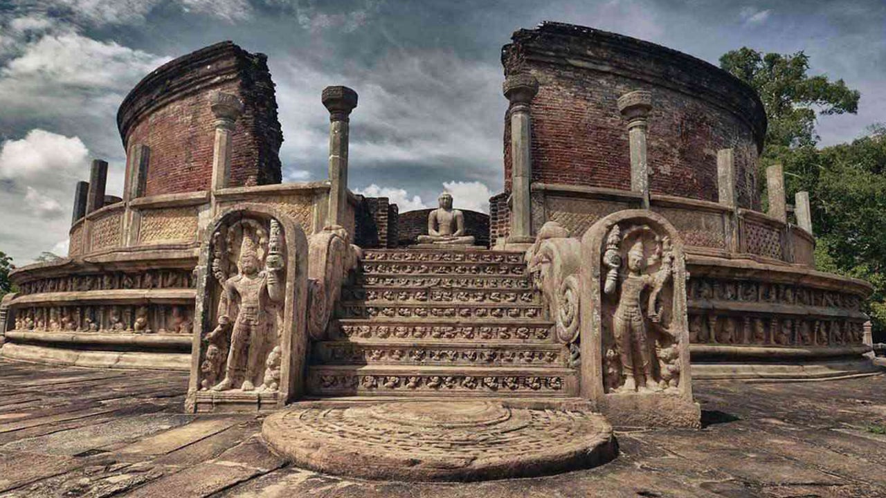


Long before the term "urban planning" entered the modern lexicon, Sri Lanka's ancient engineers were laying out cities with a precision that continues to impress scholars. The island's earliest urban centres — built across the dry-zone plains of the north-central region — were not accidental settlements but deliberately designed environments, organised around water, worship, and governance. Understanding this tradition illuminates not only the ruins that survive today but also the architectural logic that quietly persists in Sri Lanka's contemporary cities.
What made ancient Sri Lankan cities different from other early urban centres?
The defining characteristic of ancient Sri Lankan urbanism was the integration of water management into the city plan itself. Rather than treating irrigation as an afterthought, planners at sites such as Polonnaruwa designed entire civic layouts around artificial lakes, canals, and sluice systems. The wewa (reservoir) was not merely a water source — it shaped the orientation of palaces, monasteries, and residential quarters.
Cities were typically laid out on a grid or semi-grid system, with cardinal directions playing a symbolic as well as practical role. Royal precincts occupied elevated or central ground, surrounded by concentric zones of religious, administrative, and residential use — a pattern recognisable in the remains of Anuradhapura and Polonnaruwa alike. This zoning approach ensured that sacred spaces were never encroached upon by commerce or housing, a discipline that many modern cities struggle to enforce.
How did ancient Sri Lankan builders handle the tropical climate?
Climate responsiveness was built into every scale of the built environment. At the building level, thick masonry walls moderated daytime heat, while wide overhanging eaves deflected monsoon rain. Open courtyards — found in both palace complexes and monastic piriwen — promoted cross-ventilation and created shaded intermediate spaces between interior rooms and the open sky.
At the urban scale, tree-lined processional routes and the proximity of reservoirs cooled the surrounding air measurably. Ancient texts such as the Mahavamsa chronicle describe gardens and water features as deliberate civic amenities, not mere ornament. This approach — designing the city as a climate-moderating system — echoes principles that contemporary green-building certification frameworks are only now formalising.
What role did religion play in shaping city form?
Buddhism's arrival in Sri Lanka around the third century BCE accelerated urban development rather than interrupting it. Stupas — the characteristic hemispherical relic monuments — became the anchoring elements around which neighbourhoods formed. Their height, visible from great distances across flat plains, served as urban landmarks before the concept of a civic skyline existed.
The stupa typology also informed spatial hierarchy: the largest monuments occupied the centre or highest ground, with progressively smaller shrines, image houses, and monks' quarters arranged outward. Pilgrimage routes connecting these monuments doubled as the city's primary circulation network, a planning decision that kept pedestrian movement aligned with religious geography.
How did colonial rule reshape Sri Lanka's urban fabric?
When Portuguese, Dutch, and later British administrations established themselves on the coast from the sixteenth century onward, they imported European urban conventions that layered onto — and sometimes obliterated — existing settlement patterns. Dutch colonial planning favoured fortified grid towns oriented toward the sea, as seen at Galle and Negombo. The Dutch Fort in Negombo illustrates how a European military enclosure was grafted onto a coastline that had long supported local fishing communities.
British planning in Colombo introduced wide boulevard streets, public parks, and civic buildings in neoclassical and baroque styles. Structures such as the Colombo Town Hall and the Old Dutch Hospital — now repurposed as a dining precinct — remain legible examples of European civic ambition transplanted to a tropical setting. The key adaptation the British made was the veranda: almost every public building from the colonial era uses a deep covered colonnade to negotiate the relationship between interior air-conditioning and exterior heat, a concession to climate that the ancient builders would have recognised immediately.
What can visitors see in Colombo that reflects this layered urban history?
Colombo is the most concentrated site for reading Sri Lanka's architectural timeline. The Fort district preserves colonial-era street grids, warehouse frontages, and civic monuments within walking distance of each other. A Colombo city tour allows visitors to trace the transition from Dutch administrative buildings to British-era railway infrastructure to the sleek glass towers that now define the seafront reclamation area.
The Colombo Lotus Tower — the tallest self-supported structure in South Asia — represents the latest chapter in this story, its form deliberately referencing the lotus motif found on ancient Sri Lankan coins and carvings. The choice is not incidental: it signals a conscious attempt to connect contemporary ambition to a pre-colonial symbolic vocabulary.
How do Kandy and Galle compare as urban heritage destinations?
Kandy developed as the last royal capital of the Kandyan Kingdom (roughly 1469–1815), and its urban plan reflects that status. The city is organised around the Kandy Lake and the Temple of the Tooth Relic, with the palace complex, the esplanade, and the principal streets all oriented toward these central anchors. The Kandy city tour gives visitors access to this historic core, where the relationship between water, sacred space, and civic ground remains largely intact.
Galle, by contrast, is the best-preserved Dutch colonial fortified town in Asia, and a UNESCO World Heritage Site. Its grid of narrow streets, Dutch-period warehouses, and coral-stone bastions creates a coherent urban character quite unlike anything else on the island. The Galle city tour covers both the fort precinct and the adjacent modern town, making the contrast between colonial planning and organic growth immediately apparent.
What is the best time to explore Sri Lanka's urban architecture?
For walking tours in Colombo, Kandy, or Galle, the dry season from December to April generally offers the most comfortable conditions — lower humidity and reliable sunshine. However, the northern dry zone cities such as Anuradhapura and Polonnaruwa are best visited between May and August, when the inter-monsoonal period brings cooler temperatures to that region while the southwest receives heavier rain.
Early morning visits to any urban heritage site are advisable year-round: light is flattering for photography, temperatures are manageable, and crowds at key monuments are thinner. Many colonial-era public buildings in Colombo and Galle are most atmospheric in the late afternoon, when low-angle light picks out the texture of plasterwork and carved stone.
How does ancient urban planning inform contemporary Sri Lankan architecture?
A number of Sri Lankan architects working today draw explicitly on ancient planning principles. Passive cooling through courtyard design, the use of local laterite and granite, and the integration of water features into building layouts all appear in contemporary projects across Colombo and the cultural-heritage corridor of the north-central province. This continuity — interrupted but never entirely broken by colonial rule — suggests that ancient urban planning is not simply a historical curiosity but a living design resource.
The challenge for Sri Lanka's rapidly growing cities is to scale these principles to high-density urban environments. Pilot projects in eco-district planning and green-corridor infrastructure point toward a synthesis of ancient climate wisdom and modern engineering that the island's earliest city builders, working without computers but with considerable empirical intelligence, would perhaps find familiar.
Related reading
7 pages on closely related subjects.