
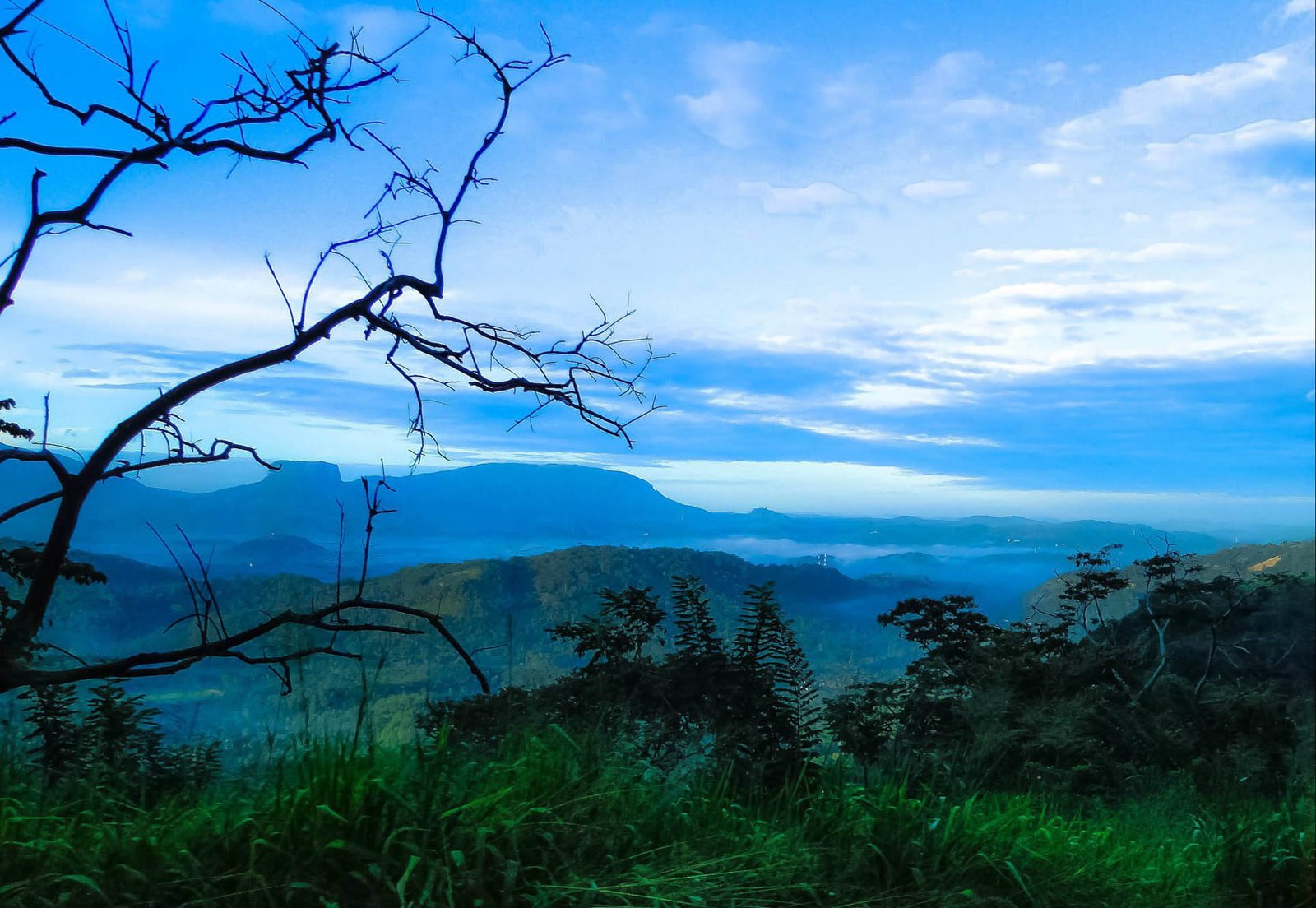
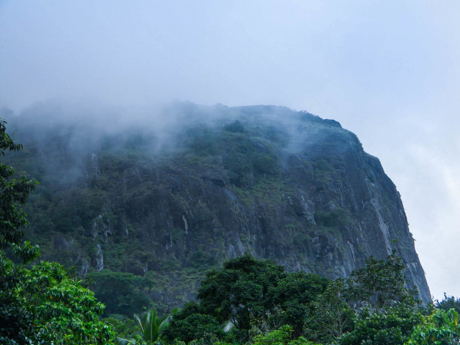
Rising 2,618 feet above the Kegalle District's forested ridges, Bible Rock — known in Sinhala as Bathalegala — is one of central Sri Lanka's most recognisable natural landmarks. Its near-vertical faces and strikingly flat summit give it the profile of an open book when viewed from the Kandy Road, a resemblance that prompted British colonial engineers to name it during the 19th century. For most travellers, it appears as a distant, square silhouette looming over the Kadugannawa Pass — impressive from the highway, yet rarely explored up close.
What makes Bible Rock so distinctive?
The rock's geometry is its defining characteristic. Seen from the A1 Colombo–Kandy Road as it winds through the Kadugannawa Pass, Bathalegala presents two roughly equal faces separated by a central ridge, mimicking the spread pages of a large open book. This unusual profile has made it a reference point for painters, photographers, and travellers for well over a century.
Geologically, Bible Rock belongs to the ancient metamorphic terrain that underlies much of Sri Lanka's hill country. Its near-vertical cliff faces and broad, relatively flat summit plateau are the result of differential weathering over millions of years — harder rock resisting erosion while softer surrounding material eroded away. The flat summit has drawn comparisons to Sigiriya: The Ancient Rock Fortress, though Bible Rock sees a fraction of that site's visitor numbers.
Where exactly is Bible Rock, and how do you get there?
Bible Rock sits near the village of Aranayake in Kegalle District, roughly midway between Colombo and Kandy. The most common approach for day visitors is to turn off the main Colombo–Kandy highway at Mawanella and follow the Hathgampola Road north-eastward toward Aranayake. The rock becomes visible from multiple points along this secondary road, growing steadily more imposing as you close the distance.
| Starting point | Approximate distance | Typical travel time |
|---|---|---|
| Colombo | ~85 km | 2–2.5 hours |
| Kandy | ~40 km | 1–1.5 hours |
| Mawanella town | ~15 km | 30–40 minutes |
Public buses run between Mawanella and Aranayake, but onward transport to the trailhead can be irregular. Hiring a private vehicle or joining an organised excursion from Kandy or Colombo is the more practical option for most visitors.
What is the Bible Rock hike like?
The ascent to the summit of Bathalegala is a moderately challenging hike that takes between two and three hours each way, depending on fitness level and trail conditions. The path climbs through mixed forest — rubber plantations give way to denser secondary jungle as you gain elevation, and the final approach involves some scrambling over exposed rock.
- Difficulty: Moderate to strenuous; some sections require use of hands.
- Best season: November to April, when rainfall on the western slopes is lower. Avoid the south-west monsoon months (May–September) when trails become slippery.
- What to bring: Sturdy footwear with grip, at least 1.5 litres of water per person, a light rain layer, and sun protection for the exposed summit.
- Start time: An early start — before 7 am — avoids midday heat and gives the best chance of clear summit views before cloud builds.
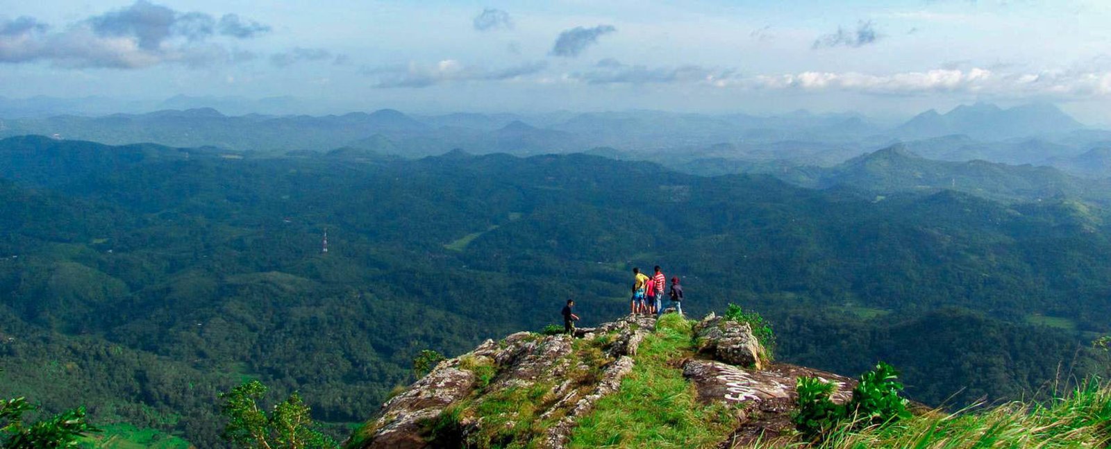
The summit plateau rewards the effort with panoramic views across Kegalle District's patchwork of rubber, tea, and paddy. On exceptionally clear mornings, the outline of Adam's Peak is visible to the south-east.
What wildlife and vegetation can you see on the way up?
The forest flanking the trail supports a reasonable diversity of birdlife, including several species of broadbill, flycatcher, and forest raptor. Mammals such as toque macaques and land monitor lizards are regularly encountered. The lower slopes pass through rubber smallholdings before entering secondary forest; the upper sections retain older growth with larger canopy trees.
The Makandawa Rainforest lies within the broader Kegalle–Kandy corridor and shares some species composition with the Bible Rock forested flanks, making the two sites a natural pairing for nature-focused itineraries.
Is there anything else to see near Bible Rock?
The Aranayake area offers a quietly rural character that contrasts with the more commercialised attractions of the Kandy region. Villages along the Hathgampola Road are surrounded by small spice gardens, paddy fields, and rubber estates — a genuinely local landscape that most visitors to Sri Lanka pass through without stopping.
- Kadugannawa Pass viewpoints: Several lay-bys along the A1 offer classic elevated views of Bible Rock from the highway itself.
- Mawanella: A practical lunch stop with local restaurants and a small market.
- Kandy: Around 40 km east, with the Temple of the Tooth, Peradeniya Botanical Gardens, and the Kandy City Tour as natural follow-on activities.
When is the best time to visit Bible Rock?
The dry season for Sri Lanka's western and central slopes runs broadly from December through April, making these months the most reliable for clear skies and manageable trail conditions. January and February tend to offer the crispest visibility at altitude. The south-west monsoon (May to September) brings heavy rainfall to the Kegalle area and makes the upper rock faces significantly more hazardous.
Morning visits are strongly preferred year-round. Cloud frequently settles over the summit by mid-morning during the wetter months and by early afternoon even in the dry season.
How does Bible Rock compare to Sigiriya?
The comparison is understandable — both are prominent flat-topped monoliths rising abruptly from lowland terrain. The differences, however, are significant. Sigiriya is a UNESCO World Heritage Site with ancient frescoes, water gardens, and a well-documented royal history, drawing tens of thousands of visitors monthly. Bible Rock is a natural geological formation with no ruins or developed tourist infrastructure, attracting a fraction of that traffic. It suits travellers who prefer uncrowded trails and an authentic rural setting over organised heritage tourism.
Practical tips before you go
- There is no formal entry fee to hike Bible Rock, though local guides from Aranayake village are worth hiring for navigation and safety on the upper sections.
- Mobile network coverage is patchy above the lower slopes — download offline maps before departing.
- Carry sufficient cash; there are no ATMs near the trailhead.
- Inform someone of your planned route and expected return time before beginning the ascent.
- Leeches are present during and after wet periods — apply repellent to boots and socks.
Nearby places
10 places within about 25 km, nearest first.
